Text
Vanuatu was hit by an unprecedented two severe tropical cyclones within 48 hours in February. Cyclones Judy and Kevin caused major damage to Vanuatu’s roads and bridges, crops and coastal fisheries, underscoring how climate change and climate-related weather events are a major challenge for important sectors like agriculture, fisheries and infrastructure.
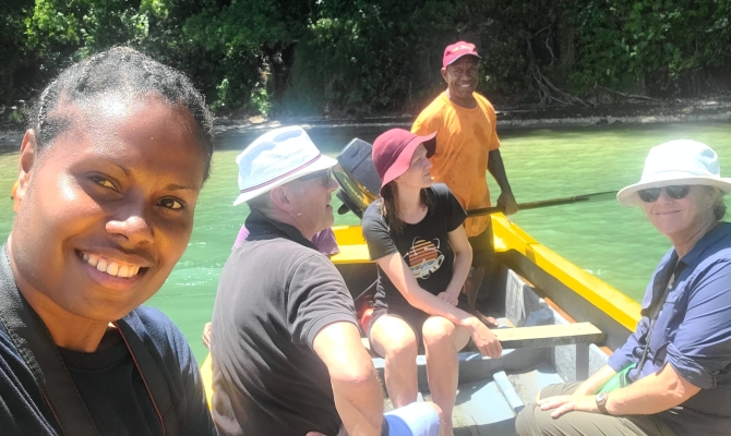
Prior to the arrival of the two cyclones, on 24-27 February 2023, a delegation from the Secretariat of the Pacific Regional Environment Programme (SPREP)-managed Climate Information Services for Resilient Development Planning in Vanuatu Project (known in Bislama as ‘VanKIRAP’ visited Tanna island to collect key climate and geo-spatial data and information of relevance to the island’s agriculture, tourism and infrastructure sectors. The delegation included the SPREP/ Vanuatu Meteorology and Geo-Hazards Department (VMGD) project management team, VMGD climate officers, sector coordinators and delivery partner, the Australian Government’s Commonwealth Scientific and Industrial Research Organisation (CSIRO).
The joint VanKIRAP-CSIRO team visited Tanna Coffee’s farm and factory at Imanaka, near Lenakel, and conducted a coastal drone survey during a site visit to the VanKIRAP ocean climate monitoring buoy at Port Resolution.
At Tanna Coffee, the team talked with local farmers, Tanna Coffee staff and Department of Agriculture and Rural Development (DARD) field officers about how climate change is affecting coffee production, and how to maintain future agricultural productivity in a changing climate.
On the other side of the island at Port Resolution, Raviky Talae, VanKIRAP’s Infrastructure Sector Coordinator, piloted a drone over Port Resolution harbour to capture high resolution LiDAR-based spatial mapping of the adjacent coastline.
The VanKIRAP Project is combining digital elevation models created from the LiDAR data with computer climate models of projected sea level inundation to produce a multi-sector hazard climate change impact assessment.
Mr. Talae says the site visit with the CSIRO team was very useful.
“ Key geo-spatial data was collected and that will be used to develop a science-based impact assessment based on long-term (multi-decadal) climate projections to be used by different sectors,” he said.
Chief of the Port Resolution community, Mr. Russel Nirua, acknowledged CSIRO and VanKIRAP for conducting the aerial survey, and asked the team to provide results of the survey to the community to help them understand how climate change is impacting their area, and what they must do to address these impacts.
The assessment will be utilised by Vanuatu Government ministries and agencies to ensure that climate change impacts are factored into future adaptation policy planning for each sector.
The visit concluded with a brief presentation at Tafea Province headquarters in Isangel, of a new climate change projections portal currently under development by CSIRO, for the VanKIRAP project that will display a range of current and future climate information.
VanKIRAP’s efforts to capture critical climate and geo-spatial data and information were proven valuable on Tanna following the cyclones.
An ocean climate monitoring buoy installed off Tanna Island at Port Resolution, one of a network of six buoys installed by VanKIRAP throughout Vanuatu, captured data on wave height and direction, wind speed and sea surface temperature during both cyclone events. On 1 March, the buoy recorded wave heights above 5m as TC Judy hit the area, and as high as 4.67m when TC Kevin passed by 2 days later.
Vanuatu’s climatologists at the VMGD, sectoral officials and disaster response managers will now use the valuable science-based insights recorded during the twin cyclone events to improve climate change impact models and decision support tools that will enable people throughout Vanuatu to increase their resilience and adaptation to future extreme climate events, including cyclones and associated storm surge.
According to Dr Geoff Gooley, CSIRO Van KIRAP project lead, the Van KIRAP project is setting a new benchmark in the western tropical Pacific for development and delivery of science-based climate change services tailored to the decision-making needs of specific sectors. Key to this imperative is the development of local capacity to collect high quality observational and geo-spatial data to better configure, validate and contextualise the climate model projections.
The Vanuatu Klaemet Infomesen blong Redy, Adapt mo Protekt (Van-KIRAP) project is a five-year, USD 22 million project which aims to support climate resilient development in Vanuatu through the development, communication, and application of climate information services to benefit agriculture, fisheries, tourism, infrastructure, waste sectors and communities. It is funded by the Green Climate Fund and implemented by the Secretariat of the Pacific Regional Environment Programme in partnership with the Vanuatu Meteorology and Geo-hazards Department, Commonwealth Scientific and Industrial Research Organisation, Australian Bureau of Meteorology, and APEC Climate Centre.
For more information, please contact Mr Sunny Seuseu, VanKIRAP Acting Manager, at [email protected]
